The National Weather Service’s Storm Prediction Center (SPC) has raised the alarm by issuing both an Enhanced Risk warning for severe thunderstorms and a Tornado Watch for several states in the southern and central Plains. With hazardous weather conditions expected to develop and intensify overnight, residents in key cities such as Oklahoma City, Norman, Wichita Falls, Denton, and Lewisville are urged to remain vigilant and take necessary precautions. This comprehensive report delves into the meteorological factors driving this severe weather event, examines the potential hazards—including tornadoes, damaging wind gusts, and large hail—and provides critical safety advice to those in the affected regions.
In the following detailed analysis, we will explore:
- Meteorological Overview: An in-depth look at the weather systems, including the mid-level short-wave trough and advancing cold front, that are fueling the severe thunderstorms.
- Regional Impacts: A breakdown of what residents in central Oklahoma, north Texas, and Kansas can expect in terms of storm development and intensity.
- Tornado Watch Details: An examination of the Tornado Watch covering parts of southwest Arkansas, southern and southeast Oklahoma, and central to northeast Texas, including timing and expected evolution.
- Hazard Analysis: A discussion of the primary threats posed by the upcoming storms, including the possibility of tornadoes, damaging winds, and large hail.
- Safety Precautions: Practical steps for individuals and families to prepare for and respond to severe weather events.
- Historical Context: How similar past events have unfolded and what lessons have been learned.
- Technological Advances in Forecasting: An exploration of the advanced tools and techniques used by the SPC to predict and track severe weather.
- Public Communication Strategies: How meteorologists and emergency management officials plan to keep the public informed throughout the event.
- Long-Term Implications: What this severe weather event means for future forecasting, emergency response, and community resilience in the region.
By analyzing each of these aspects, we aim to provide a thorough understanding of the current weather threat and equip readers with the knowledge needed to stay safe during what promises to be a dangerous period for the southern and central Plains.
I. Meteorological Overview: Understanding the Severe Weather Drivers
A. The Mid-Level Short-Wave Trough
A primary factor in this severe weather event is a mid-level short-wave trough—a localized, transient dip in the upper-level flow of the atmosphere. Originating from the Four Corners region, this trough is currently pushing eastward into the southern Plains. In meteorological terms, a short-wave trough acts as a catalyst for lift in the atmosphere. As it moves eastward, it destabilizes the air by forcing warm, moist air to rise rapidly, setting the stage for the development of severe thunderstorms.
Meteorologists explain that the energy associated with the trough is a critical ingredient for severe weather. When the trough interacts with the surrounding environment, it increases the likelihood of convective development, leading to thunderstorms that can rapidly intensify. In the present scenario, the trough is instrumental in generating the dynamic conditions necessary for both the formation of tornadoes and the intensification of severe thunderstorms.
B. Advancing Cold Front and Warm, Moist Air Interaction
Complementing the short-wave trough is an advancing cold front that is set to collide with warm, moisture-rich air streaming northward. This frontal boundary represents a significant contrast in air masses: the cool, stable air behind the front versus the warm, unstable air ahead of it. The interaction between these two air masses is a classic recipe for severe weather. As the cold front advances, it forces the warm air upward—a process known as frontal lifting—which can lead to the formation of cumulonimbus clouds, the towering behemoths responsible for thunderstorms.
This lifting mechanism is further enhanced by the presence of abundant moisture. In regions like central Oklahoma, north Texas, and Kansas, the moisture originates from the Gulf of Mexico, carried northward by southerly winds. The combination of this moisture with the lift provided by the cold front creates an environment ripe for severe convective storms, which can develop rapidly and pose significant hazards.
C. Enhanced Instability and Wind Shear
Beyond the basic ingredients of a short-wave trough and a cold front, the atmosphere in the affected region is characterized by enhanced instability and significant wind shear. Instability refers to the tendency of the air to continue rising once it is set in motion. When conditions are unstable, a small upward push can lead to the rapid development of thunderstorms. Meteorologists use indices such as the Convective Available Potential Energy (CAPE) to quantify this instability. Higher CAPE values indicate a greater potential for strong updrafts and severe storm development.
Wind shear, the change in wind speed and direction with height, is another critical factor. Moderate to strong wind shear can organize thunderstorms into supercells—rotating storms that have a higher likelihood of producing tornadoes. In the current forecast, wind shear is expected to be sufficiently strong to support organized severe storms, thereby increasing the risk of tornado formation alongside other hazards such as damaging wind gusts and large hail.
D. The Big Picture: A Convergence of Severe Weather Ingredients
When considered together, the meteorological factors at play create a perfect storm scenario. The mid-level short-wave trough acts as an initial trigger, the advancing cold front provides the lifting mechanism, and the abundance of warm, moist air from the Gulf of Mexico fuels the instability. Meanwhile, significant wind shear organizes these storms and increases the threat of tornadoes.
These conditions are expected to persist and even intensify throughout the overnight hours, making this one of the most significant severe weather events of the season. As forecasters monitor the evolving situation, they continue to refine their predictions, providing updated guidance to emergency management agencies and the public.
II. Regional Impacts: Who and What to Expect
A. Central Oklahoma, North Texas, and Kansas in the Crosshairs
The SPC has issued an Enhanced Risk warning specifically targeting central Oklahoma, north Texas, and Kansas. These states, known for their flat landscapes and open fields, are particularly vulnerable to the rapid development and progression of severe thunderstorms. Cities such as Oklahoma City, Norman, Wichita Falls, Denton, and Lewisville fall squarely within the forecast zone.
Residents in these areas should be prepared for a night of rapidly intensifying storms. The forecast indicates that severe thunderstorms could develop in the late afternoon or early evening, growing in intensity as the night progresses. With the Enhanced Risk warning in effect, the probability of encountering damaging wind gusts, large hail, and possibly tornadoes is significantly elevated.
B. Expected Hazards: Tornadoes, Damaging Winds, and Large Hail
Forecasters are particularly concerned about the potential for tornadoes. Tornadoes form when rotating thunderstorms, known as supercells, become established in environments with high wind shear and instability. The combination of these factors in central Oklahoma, north Texas, and Kansas raises the risk of tornado development, which can cause localized but severe damage.
In addition to tornadoes, severe thunderstorms in the region are expected to produce damaging wind gusts. These winds, which can exceed 70 mph in the most intense storms, have the potential to uproot trees, damage buildings, and disrupt power lines. Large hail, another hazard associated with strong thunderstorms, poses risks to vehicles, crops, and structures.
The convergence of these hazards means that the severe weather event is not only a threat to property but also to life. It is essential for residents in the affected areas to stay informed, follow official warnings, and be ready to take shelter at a moment’s notice.
C. Timing and Duration: Overnight Threat
The enhanced risk period spans the overnight hours, beginning the evening of March 3, 2025, and extending into the morning of March 4. This timing is critical because nighttime severe weather can be particularly dangerous. With reduced visibility and the fact that many people are asleep or unaware of rapidly changing conditions, the risks associated with severe thunderstorms and tornadoes increase significantly.
Authorities are urging residents to have a plan in place before the severe weather hits. Whether it is designating a safe room, knowing the location of nearby storm shelters, or keeping a battery-operated weather radio handy, preparedness is key to minimizing the impact of the storms.
III. The Tornado Watch: Expanding the Area of Concern
A. Geographic Coverage of the Tornado Watch
In addition to the Enhanced Risk warning for severe thunderstorms, the Storm Prediction Center has issued a Tornado Watch for parts of southwest Arkansas, southern and southeast Oklahoma, and central to northeast Texas. This watch is in effect from 4:10 a.m. until 11:00 a.m. CST on March 4, emphasizing that the threat of tornadoes is not confined solely to the central Plains but extends into a broader swath of the region.
The Tornado Watch indicates that conditions are favorable for tornado formation. While a watch is not as urgent as a warning (which is issued when a tornado has been sighted or indicated by radar), it serves as a critical heads-up for residents and emergency management officials. Those in the Tornado Watch area should be prepared to act quickly if a tornado warning is subsequently issued.
B. Operational Implications for Local Communities
For communities within the Tornado Watch zone, the forecasted severe weather is a cause for heightened alert. Local emergency services, including police, fire departments, and EMS, are likely to increase their readiness levels, ensuring that they can respond swiftly to any emergencies that may arise. Public shelters may be prepared to accommodate residents who need a safe place to ride out a potential tornado.
Local authorities are also likely to activate their severe weather communication channels, using sirens, social media, and emergency broadcast systems to keep the public informed. Residents should pay close attention to these communications, as they will provide critical guidance on when and where to seek shelter.
C. The Science Behind Tornado Formation
Understanding why tornadoes form can help communities appreciate the seriousness of a Tornado Watch. Tornadoes typically form in supercell thunderstorms—powerful storms characterized by a rotating updraft. The wind shear present in the affected regions, combined with the instability from the warm, moist air, creates an environment where supercells can develop. If conditions are just right, the rotation within these storms can intensify and lead to the formation of a tornado.
Forecasters rely on a combination of radar data, satellite imagery, and computer models to predict tornado formation. Although predicting the exact time and location of a tornado is challenging, the issuance of a Tornado Watch is a clear indicator that the ingredients are present, and caution is warranted.
IV. Hazard Analysis: What the Severe Weather Means for the Region
A. The Multifaceted Threat of Severe Thunderstorms
Severe thunderstorms pose a range of hazards that can impact communities in various ways. In addition to the risk of tornadoes, these storms are capable of producing:
- Damaging Wind Gusts: High winds can cause widespread property damage, from tearing off roofs to toppling trees and power lines.
- Large Hail: Hail can cause significant damage to vehicles, crops, and buildings. Hailstones can reach sizes comparable to softballs in extreme cases.
- Heavy Rainfall and Flash Flooding: Rapid, intense rainfall can overwhelm drainage systems and lead to flash flooding, which is particularly dangerous in urban areas.
- Lightning: The threat of lightning strikes increases during severe thunderstorms, posing risks to both people and property.
B. The Cumulative Impact on Infrastructure
The cumulative impact of these hazards can be substantial. For example, the combination of high winds and hail not only threatens individual homes and businesses but can also disrupt critical infrastructure such as power grids and transportation networks. Power outages, in turn, can exacerbate the challenges faced during a severe weather event by hindering communication and emergency response efforts.
Local governments and utility companies are preparing for the potential fallout by mobilizing repair crews and setting up contingency plans. However, the sheer intensity of the forecasted storms means that some level of disruption is almost inevitable. Residents are advised to secure loose outdoor items, stay indoors, and prepare for possible power outages by keeping essential supplies on hand.
C. Economic and Social Considerations
Beyond the immediate physical dangers, severe weather events have broader economic and social implications. The cost of repairing storm damage can be significant, and communities may face extended periods of disruption as repairs are carried out. Additionally, the psychological impact of experiencing a severe weather event—especially one that occurs overnight—can be profound. The stress and anxiety associated with the threat of tornadoes and other severe weather hazards can affect the mental health of residents, underscoring the need for community support and emergency planning.
V. Safety Precautions and Preparedness Tips
A. Preparing Your Home and Family
As severe weather looms, preparedness is key. Residents in the affected areas are encouraged to take proactive steps to ensure their safety and minimize potential damage. Some recommended measures include:
- Identify a Safe Room: Choose a small, interior room on the lowest level of your home to use as a safe room. Basements are ideal, but if your home does not have one, choose a small room without windows.
- Secure Outdoor Items: Bring in or secure loose items such as patio furniture, garden tools, and decorations, which can become dangerous projectiles in high winds.
- Stock Emergency Supplies: Prepare an emergency kit that includes water, non-perishable food, flashlights, batteries, a first-aid kit, and any necessary medications.
- Review Your Emergency Plan: Ensure that all family members know what to do and where to go in the event of a severe weather warning. Practice your plan so that everyone is familiar with the procedures.
B. Staying Informed: The Importance of Weather Alerts
Modern technology has made it easier than ever to stay informed about severe weather. Here are some tips to ensure you receive timely updates:
- Weather Apps: Download a reliable weather app that provides real-time alerts and updates from the National Weather Service and the Storm Prediction Center.
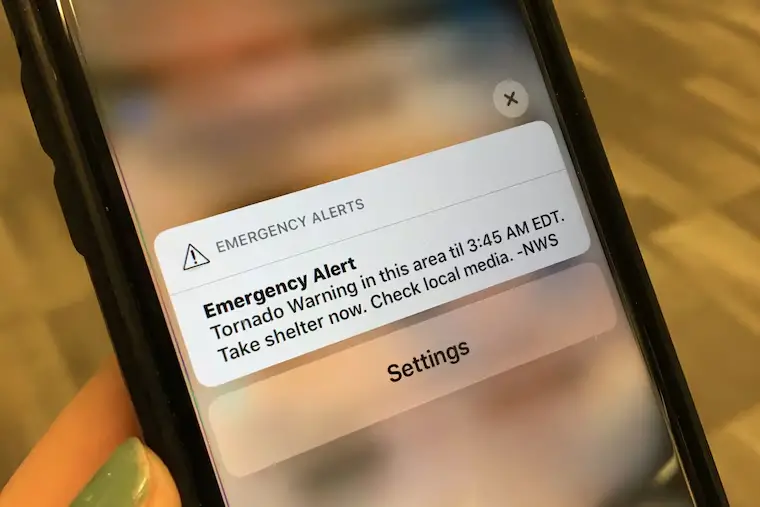
- Emergency Alerts: Sign up for local emergency alerts via SMS or email. Many communities offer free alert services that provide critical information during severe weather events.
- Monitor Social Media: Follow reputable meteorologists and local emergency management agencies on platforms such as Twitter and Facebook. These accounts often provide real-time updates and safety instructions.
- Battery-Powered Radio: In the event of a power outage, having a battery-powered NOAA weather radio can be invaluable for receiving emergency broadcasts.
C. Tornado Safety: What to Do During a Tornado Warning
If a tornado warning is issued, it is crucial to act quickly and follow these guidelines:
- Seek Shelter Immediately: Move to your designated safe room or storm shelter without delay. Do not wait to see the tornado.
- Protect Yourself: If you are in a home without a basement or safe room, get under a sturdy piece of furniture, cover your head with your arms, and crouch low to the ground.
- Avoid Windows: Stay away from windows, as flying debris can shatter glass and cause injuries.
- Listen for Instructions: Stay tuned to your weather app, local radio, or emergency alerts for updates and instructions from authorities.
D. Special Considerations for Mobile and Outdoor Workers
Those who work outdoors or are traveling during severe weather should take extra precautions:
- Plan Ahead: Check the weather forecast before heading out and have a contingency plan in place.
- Stay Indoors: If possible, reschedule outdoor activities or travel until the severe weather has passed.
- Emergency Contacts: Keep your mobile phone charged and have a list of emergency contacts readily available.
- Safety Gear: If you must work outside, wear appropriate safety gear such as helmets and sturdy shoes, and ensure you have access to shelter as soon as possible.